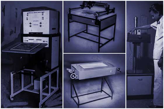
RSI Started as an opto-mechanical manufacturing unit with technical collaboration of NRSC, Dept. of Space. RSI manufactured Multispectral Additive Colour Viewer, Colour Composite Printer and Light Tables for which RSI had Indian IP rights and has deployed these equipment in every state of India.
About Us
The New Way to Success Advance Progress
Remote Sensing Instruments (RSI) is the first-generation Indian company in the field of Remote Sensing and GIS. It was started in the year 1985 as an opto-mechanical manufacturing unit, an offshoot of NRSC, Dept. of Space. With computers disrupting the industry, RSI ventured into software & related services, introduced and distributed ERDAS all over India. RSI is a long-standing total solution provider in the field of GIS and Remote Sensing with successfully executing over 500 projects all around the world.
Our History
How we started, lorem ipsum dolor sit amet, consectetur adipiscing elit ac laoreet libero.
RSI 1.0
RSI 2.0
With computers and technology disrupting the industry, RSI introduced and sold ERDAS all over India and neighboring countries. Later a JV (ERDAS INDIA) between ERDAS Inc and RSI was formed in 2000. It was renamed to RSI SOFTECH in 2009, currently involved in the development and distribution of various software/products.
RSI 3.0
With growing need for RS and GIS related services in India, RSI started a new vertical which provide consultancy services like Digitization, GIS, Image Processing, Resource Mapping, etc. RSI also distributed GIS and RS related hardware.
RSI 4.0
RSI Service vertical further diversified into Urban Mapping, Large Scale Mapping using HRS/AP, Survey/Mapping (LiDAR, Drone, GPR, GPS, DGPS, ETS), Photogrammetry, GIS application development, Mineral Exploration, Monitoring and Evaluation, Town Planning, Satellite Data Sales, etc.
RSI 5.0
With new age technology making life much easier, RSI is focused to execute world class projects with help of revolutionary Machine learning, Deep learning and Artificial Intelligence technologies
Vision
To change the day to day life of the individual with most efficient GIS and Remote Sensing Technologies and to constantly develop and market future technologies across India./p>
Mission
Our mission is to deliver innovative products, services and efficient solutions and continuously optimize and improve customer expectations through our world-class solutions and products.
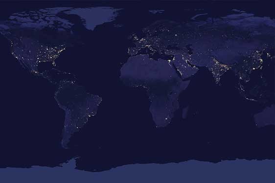
Global Presence
RSI, is the leading provider of GIS, Remote Sensing and GPS hardware and software products and related services to clients in India, UAE, Africa, Georgia, Iraq, Nepal, Bhutan, Bangladesh, Algeria, Tanzania, etc. RSI’s business encompasses Project consultancy services, software development, sales, technical support and training for numerous GIS and Remote Sensing Services, products and custom applications development.
Our Clients include most of the federal and central Ministries like Defense, Home, Agriculture, Mines, Forest, Infrastructure, Power and many Government Departments and PSUs.
RSI Signed an MOU with TCIL a PSU of Govt of India to carryout various projects in India. RSI is also a business partner for HP, Deimos Imaging and Urthecast for various products to sell across India.
RSI is empanelled with our longstanding clients to execute various projects across India